Image
Bushfire action plan
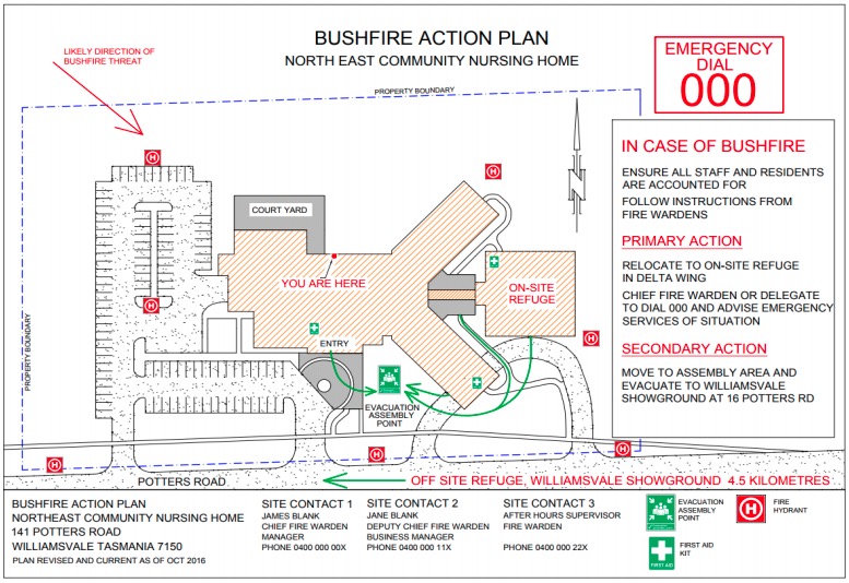
Bushfire Action Plan is a single sheet site plan diagram that provides a quick guide to occupants with essential emergency information, and is developed to complement the Bushfire Emergency Plan procedures.
The Bushfire Action Plan needs to meet the following requirements (example picture below):
- Displayed prominently within the facility or site so that staff, students and visitors are informed and able to respond safely during a bushfire emergency, including
- Displayed in each building, in locations where staff, students and visitors are able to view the diagrams
- Have a minimum size of A4
- Included as part of the School Bushfire Emergency Plan;
- May contain the following elements:
- Title
- A ‘birds-eye’ pictorial representation of the building(s) and site, including external elements such as roads, carparks and paths;
- The name of the facility or site
- The street address of the facility or site
- Date the Bushfire Action Plan was endorsed
- The YOU ARE HERE location where necessary or appropriate
- Paths of travel- coloured green
- North arrow
- Direction and distance (in km) to nearest off-site refuge (indicated by arrow and title OFF-SITE REFUGE)
- Location of assembly area(s)
- Emergency contact details